8.26.18 Describe the operational problems associated with fog

8.26.18 Describe the operational problems associated with fog

Fog has the potential to severely disrupt aircraft operations. This is due to the serious reduction of visibility which
fog causes (sometimes to less than 100 m), affecting take-offs and landings.
While in flight, fog is not a problem since it is rarely more than a few hundred feet thick. However, it can become
quite widespread at times, limiting the number of usable airfields, so caution should be exercised.
Fog may occur in any season of the year if the formation conditions are met but is most frequent from late autumn to
early spring.

8.26.16 Explain how katabatic winds may enhance or inhibit radiation fog depending on their strength

8.26.16 Explain how katabatic winds may enhance or inhibit radiation fog depending on their strength

Katabatic winds flow down valleys so if radiation fog is to form in a valley, the katabatic flow must be no more than
the 7-8 knot allowable in the radiation fog formation process. 

Radiation fog is very much influenced by topography,
and valleys often have a ready supply of moisture and light katabatic winds flowing down them, enhancing the
likelihood of fog forming (see figure 72 below).
If the valley system is big enough however – like the Rangitikei river valley for example – the katabatic wind may
become too strong and kill any chance of fog formation. Radiation fog is uncommon at Ohakea airfield.

8.26.14 Describe the meteorological conditions required for the formation and dispersal of the following;

8.26.14 Describe the meteorological conditions required for the formation and dispersal of the following;

(a) Radiation fog; 

This type of fog, also known as ‘valley fog’, will form if the following conditions are met:
If the sky is clear at night, the earth’s heat is radiated out into space as long-wave radiation. The ground cools, and
the air in contact with the ground also cools through conduction. T

his cooling process slowly spreads upwards
through the lower layers of the atmosphere. If the sky remains clear (so that cooling continues) and the air is
sufficiently moist, then condensation eventually takes place.
If the cooling process occurs in calm conditions, the cooling affects only a very shallow layer near the ground and so
only dew or frost will form. However, with a slight breeze of 1 or 2 knots, the air is mixed a little and therefore cooled
through a deeper layer. The updrafts also help in keeping the water droplets suspended in the air. 

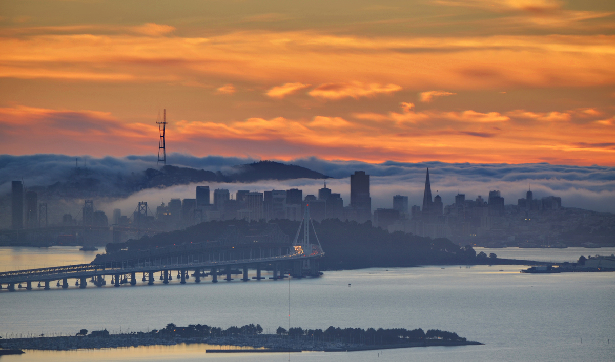
Radiation fog only forms over land; however, this will include mud flats if the tide is out. Auckland Airport is usually
only prone to radiation fog if the conditions required coincide with a low tide. Once formed, radiation fogs may drift
out over harbours and estuaries.
If the surface wind is stronger than about 7-8 knots, the depth of the friction layer is increased. This mixes warmer,
drier air from near the top of the inversion down to the surface, effectively lowering the relative humidity and
stopping the fog from forming. If radiation fog has formed and the wind then increases, it will clear through the same
process. 

Usually radiation fog clears quickly after the sun has risen. The sun’s heat penetrates the fog layer and warms the
earth below. The earth in turn warms the air above it, causing the water droplets to evaporate from the ground up.
Thus, when radiation fog clears, it usually appears to ‘lift’ into a layer of ragged low cloud which then disperses over
time as the surface temperature and dew point separate, and the cloud base rises. The presence of an upper cloud-sheet may delay the clearance of fog.

(b) Advection fog; 

The term ‘advection’ simply means horizontal transport in the atmosphere, so ‘advection fog’ (sometimes called ‘sea
fog’) results from horizontal movement, or, more simply, wind. For advection fog to form in the Southern
Hemisphere, the air must have a northerly component to it – bringing warm moist air from the sub-tropics over a
progressively cooler sea or land surface where it is cooled from below. If it is cooled to its dew point over a depth of a
few hundred feet, typically requiring at least a few days, then fog will form.
In contrast to radiation fog, advection fog will form under much less stringent conditions. The formation conditions
(related to cloud cover, location, time of day, humidity near the surface and wind) are described below, but some of
the points listed are not in fact restrictions at all; they are given for simple comparison purposes. 

So, advection fog forms:
Advection fog is much more persistent than radiation fog and, in some circumstances, may last for days. In most
cases, the clearance of advection fog occurs when there is a complete change in airmass i.e. a front passes through
the area followed by a drier airmass. In rare circumstances, the sun may warm the air enough to cause the water
droplets to evaporate.
Once formed, the fog will persist even if the wind increases to storm force, so long as the wind direction and original
airmass is maintained. Ships reporting storm force winds and huge seas with near zero visibility in fog are reasonably
common in the North Atlantic.
The fog which sometimes dogs Wellington Airport is advection fog that has formed of the east coast of the North
Island and has been dragged around Cape Palliser to arrive at Wellington in a light southerly flow.

8.26.12 List the types of fog classified by their method of formation

8.26.12 List the types of fog classified by their method of formation

Fog comes in several different forms, but each relies on the air at ground or sea-level being cooled from below to the
point of saturation, at which point condensation occurs.
The different types of fog are as follows:

 • Radiation fog: Caused by the earth cooling at night due to the loss of terrestrial radiation to space. 

Advection fog: Caused by moist air from the sub-tropics moving south over colder waters and being cooled from
below. 

• Steam fog: Formed when cold air moves over warm water. The high rate of evaporation from the water quickly
saturates the cold air above, and wispy fog forms. This form of fog is rarely a problem to aviation. 

• Frontal fog: On very rare occasions, when there is a prolonged period of rain associated with a warm front, the air
near the ground can become saturated due to the rain evaporating into it. Efectively, the cloud base continues
to lower to ground level as the frontal surface approaches. 

• Upslope fog: This is simply the cloud formation process as described in §8.22.2. So, it is low-level stratus (St)
cloud, however if you are on the side of the hill above the cloud base, you are efectively within a fog layer.
The most common types of fog experienced in New Zealand are radiation and advection fog. These are explained in
detail in next chapter

8.26.10 Explain the factors involved in slant range.

8.26.10 Explain the factors involved in slant range. 

Reported visibility is a ground-based observation and, in general, air-to-air and air-to-ground visibility will be greater – except in precipitation. In figure 70, slant range is demonstrated. The higher an aircraft flies, the greater the distance the pilot will be able to see. Thus, a pilot is likely to spot their destination airfield earlier if they fly a little higher.

Problems may arise if there is a hazy layer near the ground. Viewed from above, during an overhead re-join for
example, the airfield and its features may be clearly visible because the haze layer is shallow when viewed from
immediately overhead –  Upon lining up for finals however  the slant visibility through
the haze layer cause the airfield to disappear into the murk while the ground directly below may still be visible.
At some point along the approach,  the airfield will ‘reappear’ and the approach can be continued.
However, in such circumstances you should be fully aware of any obstacles that may exist along the approach path –
trees for example – and have a clearly set plan of action to abort the landing and climb away if you reach a predetermined decision height and the airfield is still not visible.

8.26.8 Describe the effect on visibility of the following;

8.26.8 Describe the effect on visibility of the following;

(a) Precipitation

The visibility in rain depends on both the droplet size and distribution of drops in a given volume.
The effect of drizzle or snow differs from rain because both reflect more light which causes a further reduction in
visibility.Drizzle, snow and sleet may be encountered in both warm and cold frontal conditions. Snow and sleet can also be
associated with Cb’s, where such precipitation occurs in the form of showers. 

(b) Fog or mist; 

The visibility in fog and mist is a function of how many water droplets there are in suspension in the atmosphere, and
therefore how much light scatter there is. In all other respects, the make-up and formation processes are the same.
Therefore, the diference comes down to one of actual visibility reduction caused. 

(c) Haze and smoke; 

Haze is solid particles of dust, smoke, and other chemical pollutants in suspension in the atmosphere. To be reported
in a METAR, the visibility in haze and/or smoke must reduce visibility considerably.
Visibility reductions due to haze and smoke are made considerably worse by the presence of a low-level inversion
and by airfield proximity to the sources of these two obscuration elements i.e. close to cities or forest burn-ofs etc. 


(d) Sea spray

In rough sea conditions, breaking waves result in very small sea water droplets being thrown up into the air. These
droplets then get caught in the turbulent air above the waves and tumble about rather than returning to the sea
surface. The water quickly evaporates, leaving behind minute particles of sea salt. In large concentrations, these sea
salt aerosols can reduce visibility markedly.
The worst visibilities will be along the shore-line where the waves are breaking. However, in extremely rough sea
states, visibility reductions to perhaps 10km have been observed many kilometres inland.
Rain Intensity: Visibility:
Light Little reduction
Moderate 3,000 metres – 10 kilometres
Heavy less than 3,000 metres
102
DZ or Snow Intensity: Visibility:
Light 8,000 metres or more
Moderate less than 8,000 metres but more than 500m
Heavy less than 500m
Visibility:
Fog < 1,000 metres
Mist ≥ 1,000 metres
Visibility:
Haze (HZ) & Smoke (FU) ≤ 5,000 metres Another problem associated with sea salt aerosols is that they stick to all surfaces they touch; especially aircraft
windscreens where they will form an oily sheen which can further reduce visibility. Sea salt aerosols are by far the most numerous of all condensation nuclei in the atmosphere and therefore play a
significant role in the development of cloud. They are particularly common in NZ because the country is surrounded
by ocean. 


(e) Blowing snow. 

Visibility reductions in blowing snow can be extremely poor and flying on instruments within the effected layer will
be a necessity.
Blowing snow, or ‘blizzards’, is caused by wind lifting snow of the surface. Just how high the snow is lifted is a
function of wind speed, snow state (wet or dry), and stability within the lower atmosphere. Generally, immediately
above a snow-covered surface, a very low-level inversion will exist. This limits the height to which the snow is lifted
to the lowest 100 feet or so.
For new, dry snow, a 10-knot wind will often be enough to cause visibility reductions to almost zero within the lowest
20 feet or so. Old or wet snow may require up to 40 knots to achieve the same result.
Blowing snow should not be confused with flight through a heavy snow storm. With the former, the very poor
visibility is confined to a shallow layer immediately above the surface. Visibility above blowing snow will generally be
good. The poor visibility associated with flight through a heavy snowstorm will be extremely poor through a great of
perhaps 20,000 feet or more. 

(f) Sun glare. 

Sun glare can be a serious problem for any aviator. In (a) and (b) above it was mentioned that increased light scatter
resulted in reduced visibility. Clearly, if the sun is shining directly into your eyes, your ability to ‘see’ is greatly
reduced even though the visibility may be excellent.
A good pair of sunglasses and a serviceable sun visor in your aircraft will help reduce this problem, as will keeping
the windscreen clean. Another option to overcome this problem may be to opt for a landing or take-of on a different
runway if conditions permit. 

8.26.6 Describe the operational characteristics of the visibility sensor used in Automatic Weather Stations (AWS) and reported in METAR AUTO reports

8.26.6 Describe the operational characteristics of the visibility sensor used in Automatic Weather Stations (AWS) and reported in METAR AUTO reports 

The visibility sensors used in AWS are called ‘Forward Scatter Meters’. They fire out a beam of infrared light which is scattered by minute particles floating in the air. Some of the light beam will be scattered into the
receiver about half a metre away. From the amount of scatter received, the instrument can measure the turbidity of
the air, and then calculate the horizontal visibility by extrapolation. They operate by day or night. 

The visibility is only sampled near the sensor; therefore, the limitations are: 

• The prevailing visibility may be much better than reported if there is localised mist or fog near the sensor
only. In such situations, it would be useful to view a sequence of recent reports rather than one routine
report in isolation. 

• The prevailing visibility may be very poor in some areas around the aerodrome if fog has formed over the
airfield but not near the sensor. 

• Approaching poor visibility associated with an isolated shower, or rain with a front will not be measured
until it reaches the sensor. 

• The sensor cannot determine directions where there are significant visibility variations. 

• Most of the MetService visibility sensors are limited to reporting visibility up to 20km only. Thus, when
visibility is reported as 20km, it could be considerably better than that. 

8.26.4 Explain why illumination from the sun or moon has no effect on prevailing visibility

8.26.4 Explain why illumination from the sun or moon has no effect on prevailing visibility

Visibility is not a function of illumination, but rather a function of the transparency of the air. For example, at night
the visibility might be 30km, but unless an object up to 30km away is illuminated, we can’t see it. So, to perceive objects with our eyes, they must be illuminated in some way. 

In the absence of any illumination on a very dark night,
the visibility may still be excellent. Sunlight and moonlight simply provide illumination to an already existing visibility,
but they do not alter the visibility at all.

26.2 Define Prevailing Visibility

8.26.2 Define Prevailing Visibility

Visibility is the greatest horizontal distance at which a black object can be seen and recognised against the sky at
the horizon in daylight and is a ground-based observation only. 

Prevailing visibility is the visibility as reported and forecast in METAR AUTOs, TAFs, TRENDs etc. It is the maximum
horizontal visibility covering at least half of the total horizon (note: the visibility may be a maximum in several
different directions. 

These areas do not have to be adjoining so long as their combined total covers at least half the
horizon).
Effectively, this means the prevailing visibility is the distance at which some detail can be seen. For example, if a
range of hills is 30k m away and you can see the hills but can’t make out any detail or contrast between objects, the
prevailing visibility is something just short of 30km – say 25 to 28km. For this reason, visibilities recorded by human
eyes are subjective.
If there is a large enough difference between the maximum and minimum visibilities, the minimum visibility is also
reported along with its direction.

8.24.2 Fog

Define fog

Fog is cloud on the surface whatever that surface may be