State the significance of forecast or observed low level moisture to flight
It is fitting that this should be the last objective in this manual, as it is, in my opinion, one of the most important
objectives in the Civil Aviation Authority Advisory Circular AC61-3 meteorology syllabus.
Most weather-related accidents and incidents in the GA community are related to one of two things. The first, and
most important is:
Low-level visible moisture.
And the second is:
Wind and wind related occurrences.
Any observed or forecast low-level moisture should raise a warning flag for a pilot; that is not to say that you should
immediately abandon your current or proposed flight, but rather you should give serious weight to its significance.
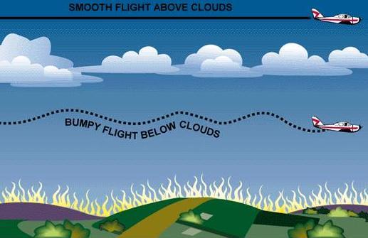
Increasing low-level moisture will inevitably lead to the development of low cloud and poor visibility in our
mountainous terrain. The combinations and rising dew points and rising ground, with an onshore flow must result in
cloud formation if sufficient lifting occurs. And if that increasing moisture is due to an approaching frontal system,
the cloud bases may start out quite high, however they will lower, and sometimes very quickly, as the dew point
temperature increases.
And don’t be fooled into thinking you need a mountain or a large hill for this to occur either. The height that the cloud
forms is not related to how high the hills are, but rather how close the temperature and dew point temperatures are.
On several occasions, I have observed broken stratus cloud at around 50 -100ft above Ohakea in moist westerly
flows. Out to sea, the air is clear of all cloud, but as this very humid air comes ashore, two things happen. Firstly, the
air is forced to rise over the sand dunes which are no more than 50 -100 ft high, so this results in lifting and therefore,
cooling. Secondly, as the air encounters the dunes, it slows down slightly because of increased friction. The air coming in from the sea is not being slowed, so it runs into this slower
moving air resulting in convergence, which adds to the lifting – sufficient for low-level cloud to form.
Another smart thing to do is monitor the dew point temperature over time. If the dew point temperature is rising,
more low-level moisture is entering the area. This will not necessarily result in cloud immediately, but if the trend
continues, at some point, low cloud becomes inevitable.
Often, a front will sweep through an area and dump quite a lot of rain. All through the rain period and often after the
rain has stopped, this added water will evaporate into the air causing the dew point to rise. If this time of rising dew
point temperatures corresponds to a rapidly falling temperature in the clear air of evening, radiation fog becomes a
distinct possibility.
Too many pilots have lost their lives by continuing to fly into deteriorating weather, which, whether forecast or not,
was either clearly visible before departure, or became visible ahead of them during the flight. In either case, such
weather is always avoidable if good decision-making processes are followed.
Flying can be heaps of fun, however when things go wrong – and they will from time-to-time – it can rapidly become
a very stressful pursuit. Some things, like a sudden engine failure for example, are drilled into you through practice,
practice and more practice. You hope the engine will never fail, but you instinctively know how to deal with it when it
does happen.
Being caught out by bad weather though, is simply something that should never happen. ALL flights at PPL level into
poor weather must have resulted from a poor decision by the pilot. Either you took off in already existing poor
conditions or you decided to continue the flight into poor weather ahead – forecast or not.
A Decision-making Flow chart:
Figure 102 presents a GOOD decision-making flow chart for any flight with regard to poor weather. The aim of every
flight should ultimately be to reach the yellow highlighted box. You don’t have to have a beer and tell war stories, but
the fact that you could if you chose to, means you have reached the ultimate goal – you’re still alive and, hopefully,
the aircraft is still in one piece.
Everything that has gone before in this book, has been written to educate you, and prepare you, for some of the
weather experiences you will come up against during your flying career as a recreational pilot.
A bad forecast, a good forecast, or even the lack of a forecast, never killed anyone. Forecasts are simply planning
data written on a piece of paper or on a computer display. They are certainly designed to help you make good
decisions, but they don’t make the decision for you – you make those decisions yourselves
As pilots, you alone hold the key to a long and enjoyable participation in aviation. Train yourself to set your own
weather limits and don’t ever push those limits. The weather can be very unforgiving to aviators. Don’t let that one
bad decision become the last decision you ever make.
Insert Flowchart of good decision making during a Cross Country Flight

.png)