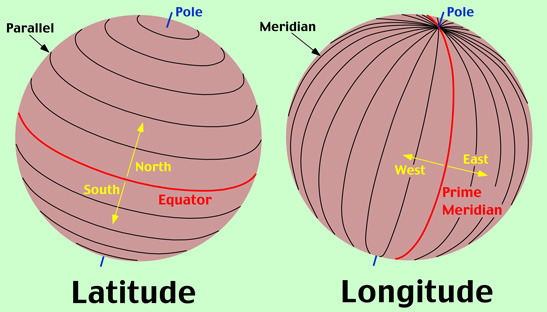
6.2.4(d) Parallels of latitude;
Your issue now is this
You have travel a distance of 161 along your track,
HOWEVER found that you are off your intend track by 4 mn
You need to do a quick mental calculation first ...
Seen as your distance of 161 is over 120nm then your degress would be aleast half of 4 e.g.(2)
Your issue now is this
You have travel a distance of 131 along your track,
HOWEVER found that you are off your intend track by 3 mn
You need to do a quick mental calculation first ...
Seen as your distance of 131 is over 120nm then your degress would be aleast half of 3 e.g.(2)
Your issue now is this
You have travel a distance of 26 along your track,
HOWEVER found that you are off your intend track by 4 mn
You need to do a quick mental calculation first ...
Seen as your distance of 26 is under 30mn then your degress would be aleast double 4 e.g.(8)
State the Two Types of Radar Currently used in New Zealand.
Currently in New Zealand, we use two types of radar:
1. Primary Surveillance Radar (PSR),
2. Secondary Surveillance Radar (SSR).

Mark the following on a map:
a)  departure aerodrome, turning points, and destination aerodrome;
b)  tracks;
c)  heading change markings, either 1:60 or drift lines;
d)  ETA amendment markings.
When marking points on a map, we must ensure care is taken that it is easy to read and gives clear precise information.
The more information we put on our map, we can calculate more information including ground speeds and position fixes.
When marking positions and times on the map, we must ensure we have an accurate position fix, and that we use an accurate time. Any time we change headings, figure we are off track or any other change in flight including crossing half and quarter waypoints, we would record the position and time.
With the times recorded, we can see how long it took between points, and also calculate a distance. With a time to travel a distance, we can calculate the speed. With this new speed (which will probably be different to your flight planned speed, we can amend our ETA to locations)
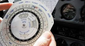
Here is another a pet calculation you could choose to use
|
Example 1. Lets look at the 3 times table eg 3 x 2 = ?? and 3 x 3 = ?? |
|
|---|---|
| Setup | |
|
1. Find the 3 or 30 on the outside scale
|
|
| Read off | ( 3 x 2 = ?? ) |
|
2. now look around on the inside for 2 and |
|
| Read off | ( 3 x 3 = ?? ) |
|
5. now look around on the inside for 3 and |
|
|
More Examples. |
|
|---|---|
| Setup | And without changing anything you can also read off |
|
|
|
| Read off | ( 3 x 15 = ?? ) |
|
3. now look around on the inside for 15 and |
|
| Read off | ( 3 x 70 = ?? ) |
|
5. now look around on the inside for 70 |
|
Using a Navigation Computer, solve triangle of velocity problems (given four of the six variables):
a)  Heading and Track (2);
b)  TAS and GS (2kts);
c)  Wind Velocity (3/ 3kts);
d)  Drift (1);
To calculate the above informationon a flight computer, we use the wind side which enables us to input known information, and calculate unknown information.
The process of using the Flight Computer is explained in a previous chapter
[vfr_FlashCards p1=”6.26″]
[vfr_FlashCards p1=”6.22″]
Define:
a)  Sunrise;
b)  Sunset;
c)  Daylight;
d)  Twilight;
e)  Morning civil twilight (MCT);
f)  Evening civil twilight (ECT).
Sunrise is the precise time the upper edge of the sun appears over the visible horizon.
Sunset is the precise time the upper edge of the sun disappears below the visible horizon.
Daylight is the time between the beginning of MCT (morning civil twilight and the end of ECT (evening civil twilight. Daylight is made up of the hours of morning twilight, sunlight and evening twilight.
Twilight is when the sun is below the visible horizon, but there is a glow in the sky caused by the reflection of the sun’s rays from the atmosphere.
MCT (morning civil twilight) begins when the centre of the rising sun’s disc, is 6 degrees below the sensible horizon.
ECT (evening civil twilight) ends when the centre of the setting sun’s disc is 6 degrees below the sensible horizon.
6.14.2(d) Cross wind;
A Cross Wind is a wind which acts perpendicular (or close to) our track or runway.

