8.24.8 Describe the characteristics of the following types of precipitation

Describe the characteristics of the following types of precipitation:
a)  continuous; 
b)  intermittent; 
c)  showers. 

a)
Continuous precipitation such as rain, drizzle or snow implies thick and extensive cloud not likely to clear in the short term

b)
Intermittent precipitation suggests that temporary improvements are likely

c)
Showers of rain, hail or snow can only form from cumuliform cloud
Characterised by bright periods between periods of precipitation
Showers have sudden onset and cessation

8.24.10 Define the rate of precipitation

Describe the following rates of precipitation:
a)  light; 
b)  moderate; 
c)  heavy. 

Assessed by monitoring a rain gauge
The larger the drops the heavier the precipitation

a) Light

Between a trace of rain and 2.5 mm per hour

b) Moderate

 More than 2.5 mm per hour and less than 10 mm per hour

c) Heavy

More than 10mm per hour

8.24.8 De

Describe the following terms in relation to precipitation: 

(a) Continuous rain; 

Continuous rain only falls from stratiform or layer cloud: nimbostratus (Ns) and, sometimes, from thick altostratus
(As) or stratocumulus (Sc). Rain is characterised by a gradual beginning and ending, and a steady rate of fall.
Sometimes breaks occur in the rain for a short period. In this case, there is not a break in the cloud sheet, just a
thinning of it. 

(b) Intermittent rain;
Intermittent precipitation is like continuous precipitation in that it falls from layer clouds. The only difference is that
the clouds are slowly thinning, and the rain is becoming intermittent prior to cessation, or the cloud is slowly
thickening, in which case, the rain will eventually become more persistent. 

(c) Showers. 

Showers fall only from cumuliform cloud – cumulonimbus (Cb) and sometimes well-developed towering cumulus
(TCu) i.e. from the “tall, towering” type clouds. Showers are characterised by their abrupt beginning and end and by
the generally rapid and sometimes violent variations in the intensity of the precipitation. In general, they are of short
duration with fine intervals between the showers. There can be showers of rain, sleet, snow or hail.

8.24.6 State the difference between large drizzle and small rain droplets

8.24.6 State the difference between large drizzle and small rain droplets

Scientifically, the changeover point from a large drizzle droplet to a small rain droplet occurs at 0.5mm, however
measuring the size of a droplet would be very difficult without some very expensive instrumentation. 

A much easier way to measure droplet size exists – simply look at the droplets falling into a puddle. If the droplet
creates a ringlet which spreads out across the puddle, it is a rain droplet. If there is NO ringlet, it is a drizzle droplet –
simple as that.

8.24.4 Describe the following types precipitation ..

Describe the following types of precipitation:
a)  rain; 
b)  drizzle; 
c)  snow; 
d)  sleet; 
e)  hail. 

a) Rain (-RA, RA +RA, -SHRA, SHRA, +SHRA); 

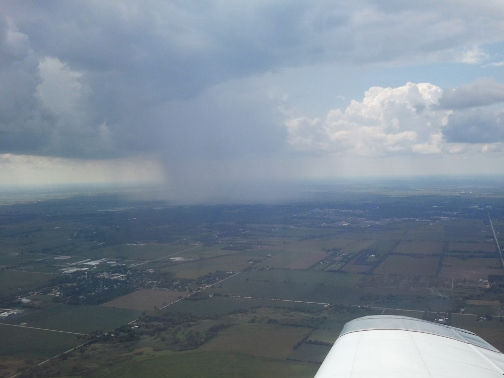
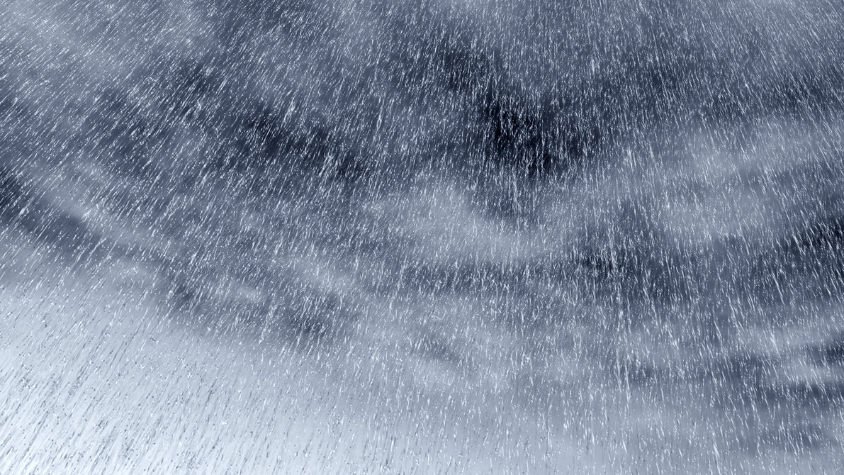
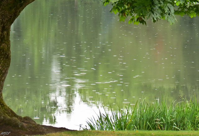
Rain is liquid precipitation (with droplet sizes bigger than drizzle droplets – see 8.24.6). Most rain in New Zealand
starts life as snow which melts when it falls beneath the freezing level. Rain comes in two forms – continuous and/or
intermittent from stratiform cloud, and showers from convective type clouds. 

(b) Drizzle (-DZ, DZ, +DZ); 

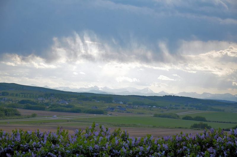
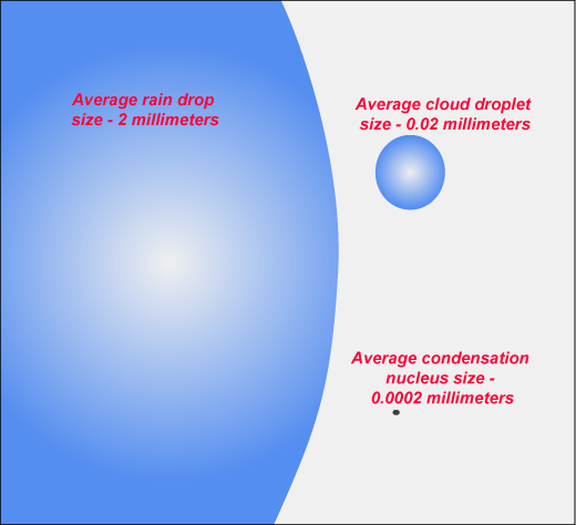
Drizzle is uniform precipitation composed exclusively of small droplets of water very close to one another. The drops
appear almost to float, thus making even slight movements of the air visible. Drizzle falls from a continuous and
97
Meteorology for PPL Pilots (Ed 2) © Meteorological Service of New Zealand Ltd
dense layer of STRATUS cloud, usually with a low base which may, at times, touch the ground. To an aviator, the
worst feature of drizzle is the reduction in visibility which can be very marked at times. 

(c) Snow (-SN, SN, +SN); 

Snow consists of ice crystals which have coalesced to form a snowflake. Snow occurs when the freezing level is so
near the earth’s surface that aggregations of ice crystals do not have time to melt before reaching the ground.
Generally, this means that the freezing level must be below 1000 ft AGL. 

(d) Sleet (-SNRA, SNRA, +SNRA, -RASN, RASN, +RASN); 

Sleet (a mixture of rain and snow) is especially likely when the air temperature at the surface is about 1 to 2°C. Sleet
rarely occurs with an air temperature above 4°C. 

(e) Hail (-GR, GR, +GR and -GS, GS, +GS)

Hail starts life as an ice embryo high up in a Cumulonimbus (Cb) cloud. This embryo gets caught up in the cycle of
updrafts and downdrafts within the cloud, gaining a layer of rime ice each time it reaches the higher, colder levels in
the cloud and a layer of clear or glaze ice when it is in the lower, warmer (but still colder than zero Celsius) part of the
cloud. Note that these processes are identical to those which cause airframe icing (see §8.28).
Hail eventually becomes too heavy to be supported by the up-drafts and falls from the cloud base or is ejected from
the side or even from the anvil of the cloud.
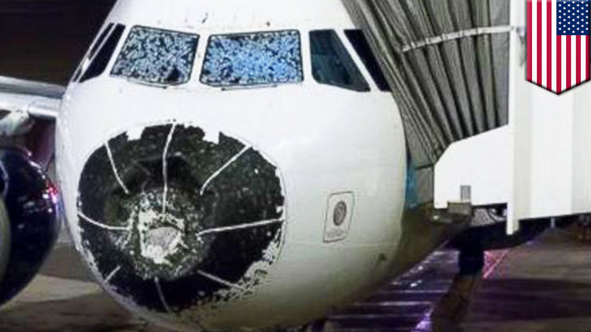
Most hail in New Zealand is small and is sometimes also called “graupel”. But in intense storms, large hail can reach
marble or even golf ball size and may be encountered in clear air up to 5 km from the anvil of the cloud that
produced it.

b) Drizzle
This is generally associated with shallow low level cloud such as stratus.
Droplets are fine and close together

C) Snow

d) Sleet

e) Hail

8.24.2 Define..

Define:
a)  precipitation; 
b)  virga. 

a) Precipitation
– means liquid drops or ice crystals falling from cloud and contacting with the surface. It comes in many forms;

 – Drizzle
 – Freezing Drizzle
 – Rain
 – Freezing Rain
– Snow
 – Sleet
 – Hail – small or large
 –

b) Virga

This is any type of precipitation which falls from a cloud but which evaporates before reaching the ground 

8.20.4 Explain how cloud drops can grow through the following..

Explain how cloud drops can grow through:
a)  the presence of ice crystals (Bergeron process); 
b)  coalescence. 

a)
In the presence of ice crystals (snow flakes) water vapour will deposit on the ice – growing the cloud drops
Clouds involved must be partly colder than freezing

b)
This is the principle of the cloud drops fusing together
There needs to be some large cloud drops formed on large condensation nuclei

8.18.14 What are the terms used for describing the characteristics of cloud.

What are the terms used for describing the characteristics of cloud.

The main method for characterising the amount of cloud is with the octas system. It works by describing how much the of the sky is covered by cloud, out of 8. 8/8 means that the entire sky is covered in cloud. 

Few               1-2           FEW

Scattered      3-4           SCT

Broken          5-7           BKN

Overcast        8             OVC


8.18.12 Cloud types and descriptions

 Describe the following types of cloud and include a description of likely icing, turbulence and precipitation: 
a)  cirrostratus; 
b)  cirrocumulus; 
c)  cirrus; 
d)  altostratus; 
e)  altocumulus; 
f)  stratocumulus; 
g)  stratus; 
h)  cumulus; 
i)  cumulonimbus/towering cumulus; 
j)  nimbostratus. 

g) Stratus

  • Grey blue appearance 

Low level cloud

Grey / blue low level cloud with a fairly level base
Vertically it is no higher than 1-2000 ft

h) Cumulus

  • Formed from orographic lifting 
  • Low – Mid troposphere 
  • Unstable air 

Low cloud level
This is a detached cloud usually found in low or middle troposphere layers.
This is bright white when viewed from the sunny side but dark and menacing viewed from the base or from the shadow side

– fair weather cumulus appears mid morning on sunny days and reaches peak development mid afternoon.
Precipitation is not common in mid -latitudes but can cause brief heavy showers in the tropics
– cumulus formation from orographic lifting common in NZ
Formed when unstable air is blown over hills and mountains and when the cloud development is not associated with frontal activity or a depression 
Has a level base slightly above mountain ridge height – seen in mountains on fine days.
Depending on the degree of instability cloud tops can be a few thousand feet above the mountains or much higher – precipitation occurs when cumulus is well developed – the valleys often remain dry

a) Cirrostratus: 

  • Covers large segment of the sky
  • Thinly concentrated ice crystals 
  • No precipitation

High level cloud

This has a smooth and fibrous appearance often covering large segments of the sky
When sun or moon have a halo around them it often indicates approaching bad weather
At these heights the temperatures are often so cold that clouds consist of ice crystals and are thinly concentrated
There is no precipitation from these clouds

b)  Cirrocumulus: 

  • Thinly concentrated ice crystals 
  • Wool like appearance 
  • No precipitation 

High level cloud

Looks like a sheep’s wool appearance with small ripples arranged in a regular fashion
It can cover small or large parts of the sky.
Temps are so low that the cloud consists of ice crystals thinly concentrated and therefore no precipitation

c) Cirrus

  • Formed from ice crystals 
  • No precipitation 
  • White feather like appearance 

High level cloud

This has a pure white feather type of appearance sometimes with streaky outlines indicative of high altitude winds
The temperatures are so low due to the high altitude – cloud is formed from ice crystals and hence no precipitation

d) Altostratus

  • Thick and high water content 
  • Smooth blue grey fibrous appearance
  • Ice above freezing level
  • Varying levels of precipitation 

This is medium level cloud
Has a blue / grey smooth and fibrous appearance which often heralds approaching bad weather.
It can be substantially thick and thus have a high water content – sun or moon not visible through it.
Ice will be encountered above the freezing level
Precipitation varies at sea level – from nothing when the cloud base is high to light when the base is lower.
In mountainous terrain though precipitation occurs near the tops of hills and can be moderate to heavy or snow or sleet depending on the freezing level

e) Altocumulus

  • Grey white appearance 
  • Covers large parts of the sky 
  • Rarely precipitation 

Middle level cloud
This is a grey / white cloud which looks like Cirrocumulus but with larger ripples or rolls arranged in regular patterns.
This often covers large segments of sky often with broken patches through
Not usual for any sort of precipitation

f) Stratocumulus

  • Grey white patches appearance with dark parts 
  • Can cover entire sky 
  • Some light turbulence 
  • Light precipitation can occur 

Low level cloud
Appears as grey or white patches, sheets or layers almost always with dark parts composed of rounded masses or rolls
When “capped” by an inversion the tops are flat
Often the result of early morning mixing within the friction layer – so when formed can cover the entire sky
Some light turbulence happens in the cloud base
Precipitation of light showers or drizzle patches can occur

i) Cumulonimbus/Towering cumulus; 

  • Unstable 
  • Can reach vast heights 
  • Thunderstorms
  • Heavy precipitation 
  • Turbulence

Low – High level cloud

Associated with unstable air
Can start at low levels and reach into the middle of higher layers
Heavy, dense and accompanied by thunderstorms
Bright white when viewed from the sunny side but at the base looks dark and menacing
Precipitation in the form of rain or hail showers is common
Turbulence as well as strong up and down draughts are serious potential problems

 j) Nimbostratus

  • Stable air
  • Dark and heavy
  • Heavy precipitation 
  • Poor visibility
  • Large amounts of water

Low – High level cloud

This starts at low levels and can extend many thousands of feet upwards.
Associated with stable air
Nimbostratus is very extensive and not well defined at the edges
Looks dark and heavy
Accompanied by heavy and persistent rain (snow in colder climates)
Visibility is poor beneath the base – not suitable for VFR flying
Contains a large amount of water

8.18.8 Differentiate between cloud droplets and rain/shower drops.

Differentiate between cloud droplets and rain/shower drops.

Cloud drops are very small compared to rain drops; ie thousands of times smaller.

When cloud drops fall from clouds, their small size facilitates evaporation and remains invisible to the naked eye.