6.14.2(e) True heading;
An aircraft’s heading is the direction that the aircraft’s nose is pointing in relation to True North
6.14.2(e) True heading;
An aircraft’s heading is the direction that the aircraft’s nose is pointing in relation to True North
6.12.2(e) Ground level;
Ground level is defined as the mean elevation of the selected area or ground feature.
This elevation is taken from mean sea level, and gives us the height of the ground.
6.10.4(a) Place name;
Place names are used for means of visual navigation with the ground.
Certain known towns, cities, land features alike are used to make position reports, which all pilots in the area are aware of and know the position. This ensures when pilots make position reports, other pilots know where they are.
6.8.2(e) True airspeed (TAS).
The true airspeed (TAS; also KTAS, for knots true airspeed) of an aircraft is the speed of the aircraft relative to the airmass in which it is flying.

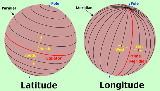
The nautical mile is defined as the length of an arc of a great circle which subtends an angle of 1 minute (of a degree) at the centre of the Earth.
Simplified; if you draw a 1 minute angle from the centre of the Earth along a great circle, then the distance along the Earths surface will be 1 nautical mile.
Due to the compression of the Earth, the arc at the poles is ‘flatter’ and therefore slightly longer (6108ft) where at the equator it is slightly smaller (6046ft)
The nautical mile is the primary unit for indicating distances in aviation.
The distance for a nautical mile is 6076 feet, however for practical purposes, it is taken as 6080 feet (1852m)
|
Magnetic Deviation, is where the plane’s compass will deviate from the actual Magnetic direction. The error induced in a compass by local magnetic fields within your aircraft (e.g headset, radios etc) Compass Direction = Degrees C Lets take a closer look at this aircraft Deviation Card. Example 1: For Magnetic 090 need to steer 092. East is Least and West is Best applies here too. so on 090°M there is a deviation of 2°W to get 092°C Example 2: And for Magnetic 225 we need to steer 222. Remembering! East is Least and West is Best.
so on 225°M there is a deviation of 3°E to get 222°C |
 |
|---|
Example 1
Example 2
Your issue now is this
You have travel a distance of 166 along your track,
HOWEVER found that you are off your intend track by 8 mn
You need to do a quick mental calculation first ...
Seen as your distance of 166 is over 120nm then your degress would be aleast half of 8 e.g.(4)
Your issue now is this
You have travel a distance of 53 along your track,
HOWEVER found that you are off your intend track by 5 mn
You need to do a quick mental calculation first ...
Seen as your distance of 53 is under 30mn then your degress would be aleast double 5 e.g.(10)
Your issue now is this
You have travel a distance of 163 along your track,
HOWEVER found that you are off your intend track by 6 mn
You need to do a quick mental calculation first ...
Seen as your distance of 163 is over 120nm then your degress would be aleast half of 6 e.g.(3)
State the Two Types of Radar Currently used in New Zealand.
Currently in New Zealand, we use two types of radar:
1. Primary Surveillance Radar (PSR),
2. Secondary Surveillance Radar (SSR).

Mark the following on a map:
a)  departure aerodrome, turning points, and destination aerodrome;
b)  tracks;
c)  heading change markings, either 1:60 or drift lines;
d)  ETA amendment markings.
When marking points on a map, we must ensure care is taken that it is easy to read and gives clear precise information.
The more information we put on our map, we can calculate more information including ground speeds and position fixes.
When marking positions and times on the map, we must ensure we have an accurate position fix, and that we use an accurate time. Any time we change headings, figure we are off track or any other change in flight including crossing half and quarter waypoints, we would record the position and time.
With the times recorded, we can see how long it took between points, and also calculate a distance. With a time to travel a distance, we can calculate the speed. With this new speed (which will probably be different to your flight planned speed, we can amend our ETA to locations)