8.32.4 In Fohn wind conditions describe the typical weather for the following;
a) To windward side of the mountain range
b) Above the mountain range
c) On the lee side of the mountain range
(a) To windward of the mountain range;
When Föhn conditions exist in the east of the country, the weather to windward of the mountain range will almost
certainly be unflyable by most pilots. Cloud bases will be extremely low (perhaps 100 to 500ft AMSL), often with
heavy precipitation and very poor visibility. Frequent embedded thunderstorms are also a distinct possibility.
Definitely NOT VFR flight conditions.
(b) Above the mountain range;
About and immediately to the west of the ridge line, conditions will be like those explained in (a) above,
with the addition of extremely strong winds, especially through the passes and valleys leading up to them.
(c) On the lee side of the mountain range.
Immediately to the east of the ridge line, there will be a rapid clearance of most of the cloud below the mountain tops.
This is because the air immediately in the lee of the mountain range is ‘dumping’ and therefore warming up causing
the cloud to evaporate. Often, a layer of higher cloud with bases around 15 – 20,000 ft will exist.
Often the precipitation doesn’t stop, as large rain droplets can be blown well downstream and appear to fall from
relatively clear skies. Visibility in this rain is usually not bad, however, as the droplets are widely spaced.
So, weather wise, flight conditions in the east could best be described as OK for VFR flight. However, the big problem
will be the large areas of moderate to severe turbulence at heights between ground level and about 1.5 times the
115
Meteorology for PPL Pilots (Ed 2) © Meteorological Service of New Zealand Ltd
height of the range. At times, in strong flows, this turbulence may border on extreme, especially in rotor zones (see
figure 59).
8.32.2 Define Fohn Wind
The Föhn wind is a warm, dry and very gusty wind blowing down the lee side of a major mountain range. ‘Föhn’ is
the name of the strong southerly wind which blows over the Alps in Europe, and the name has been adopted here in
New Zealand to describe the strong Nor-wester which frequently blows from the Hawkes Bay to south Otago.
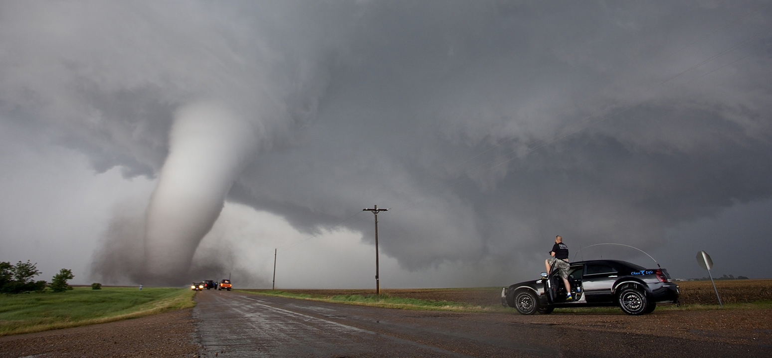
Explain the origin and development of tornadoes and state the main hazards.
Tornadoes are rotating funnels or air sucked up from below the base of Cumulonimbus cloud
They are caused by extremely strong upward motion
The high rotational velocity of a tornado is produced when there is an existing rotation of air beneath the Cb and this air is drawn into the base of the cloud through convergence
Hazards:
Windshear at low altitudes – at particular risk on take off or approach
8.30.8 Explain why light aircraft should always avoid flight in the vicinity of thunderstorms
- While many aircraft have successfully flown through thunderstorms in New Zealand and overseas, there is a very
large number of aircraft that have crashed during the attempt.
- The dangers are simply not worth the risk.
- In terms of
VFR flight anywhere near Cb clouds by inexperienced PPL pilots, the best advice is simple:
AVOID AVOID AVOID
Describe the hazards associated with thunderstorms
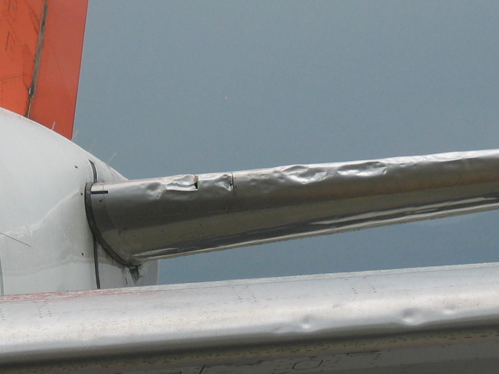
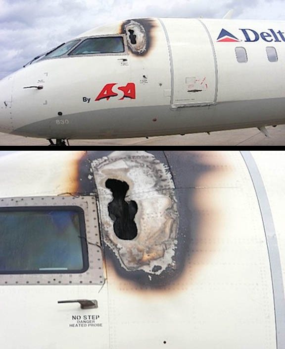
There are many hazards to light aircraft in and around thunderstorms. These hazards can cause serious structural damage to the aircraft, and possibly enough damage to bring the aircraft down; hence should be avoided.
There are eight hazards associated with thunderstorms. This objective does not ask for a description of each of these hazards. Suffice it to say, that each of these hazards
individually has the potential to cause severe damage, if not total destruction to an aircraft in flight. When occurring
simultaneously in any combination, the threat posed by thunderstorms (Cb clouds) cannot be understated.
The turbulence associated with thunderstorms is covered in more detail in §8.40.6 (a).
Main hazards are:
Severe Turbulence
– caused by severe gusts and drafts, wind shear factors
– large fluctuations in airspeed and height severe stresses on the airframe
Severe icing
– within the cloud, icing will be encountered above the freezing level but hail down to the surface can produce the same problems
– hail can be dangerous due to impact forces on thin windscreens and skins
– ice on wings and propellers will increase weight and drag and reduce lift and thrust
Lightning:
– not a major risk – but if the aircraft is struck – damage can be done to structures
Noise
– can be disturbing and distressing when loud if flying in hail showers
Microbursts
Gust Fronts
Very poor visibility
Tornadoes
Explain the development, and describe the characteristics of:
a)  orographic thunderstorms;
b)  heat type thunderstorms;
c)  frontal thunderstorms.
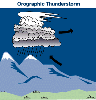
a) Orographic Thunderstorms
– found in mountainous terrain
– moist and stable air is forced to rise
– transport of this air onto mountains results in an increased water content and heavy precipitation
– if the mass of unstable moist air keeps arriving orographic thunderstorms persist for long periods of time
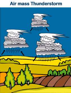
b) Heat type Thunderstorms
– moist unstable air is heated from below by a warm surface, producing strong instability
– since most warm land surfaces reach maximum temperature during the early afternoon, heat type thunderstorms over land are most active during that time of the day
c) Frontal Thunderstorms
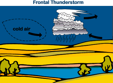
– cold fronts are often associated with Cumulonimbus formation when the rising warm air ahead of the front is unstable and lifted up at a fairly fast rate
– frontal thunderstorms are associated with vigorous cold fronts which have low cloud bases
Describe the three stages of thunderstorm development.
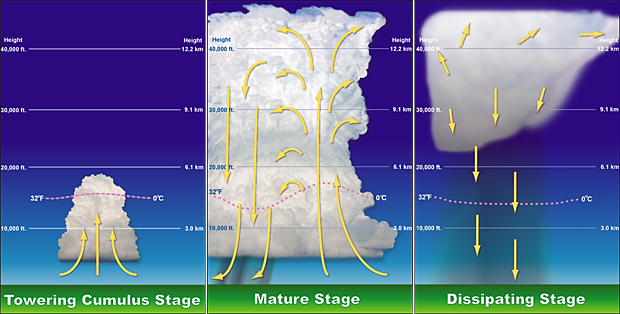
1) The Growing Stage:
Cumulus cloud grows to great development which in mid latitudes can cause tops to reach 25 – 30000 ft
All drafts within the cloud are upward and strong enough to prevent the large amounts of water and ice carried aloft from falling down
No down drafts – no precipitation
1) Cumulus or Developing Stage, involves updrafts only, with huge amounts of latent heat
released due to cloud formation. Because there are no downdrafts, turbulence is no more than light to moderate and
most of the other hazards associated with Cb development have also yet to materialise. There is however, one hazard
that may reach a severe state at this stage, and that is airframe icing due to the large and numerous super-cooled
liquid water droplets being carried aloft into the cloud by the updrafts.
Light rain is possible during this stage of development.
2) The Mature Stage:
The large amounts of water and ice have been lifted to great altitudes they become too heavy and then start to fall often at a very great rate.
When doing so they oppose the updrafts which reduced the updrafts
Therefore a large amount of turbulence is caused between the up and down drafts
A gust front / squall line forms some distance ahead of the Cb cloud
Toward the end of the Mature stage the upper portion of the Cb cloud develops an typical anvil-shaped top which is Stratiform cloud – which consists of ice crystals formed as a result of rising air balancing with high level air
Any of the eight hazards associated with Cb’s may now exist, although it is extremely unlikely that a tornado will form out of an upright, stationary Cb cloud . This stage is characterised by the onset of heavy precipitation at the surface. An anvil will start to form at the top of the cloud as the droplets spread out horizontally beneath the tropopause.
3) The Anvil or Dissipating Stage.
Once the anvil starts to become glaciated, with clear signs of cirrus and/or cirro-stratus cloud development, the Cb
has entered the final stage in its life cycle. The updrafts cease, and the hazards quickly weaken and disappear. Often
the bottom two-thirds of the cell will evaporate, leaving the cirrus anvil behind. This remaining cloud is benign.
Each stage lasts about half an hour on average, so the total life cycle of an upright, stationary Cb is around 1.5 – 2
hours’ total. Be wary, however, as Cb’s rarely form in isolation. There are usually other cells in the vicinity at different
stages in their life cycles.
Drafts within the Cb cloud stop so that all remaining drafts are downward.
Turbulence within the cloud may decrease and precipitation underneath the CB base is heavy
Explain the conditions required for the development of thunderstorms
The formation of thunderstorms requires the formation of cumulonimbus cloud developing in very unstable, saturated air. ,
1) The trigger mechanism can be caused by a front, orography, convection or low-level convergence.
2) The adequate supply of
moisture
provides the ‘fuel’ for the Cb development through the release of latent heat as the cloud forms.
3) Conditional Instability through a deep layer
The release
of latent heat destabilises the atmosphere and accelerates the updrafts. This causes more cloud to form, which
releases more latent heat, which accelerates the updrafts. This feedback mechanism feeds what is effectively a huge
heat engine. Moisture content at ground level also determines the height of the cloud base. Therefore a very steep ELR (environmental lapse rate)
Explain how atmospheric stability enhances terrain channeling
When airflow encounters hills in its path some of the air will be forced to rise over the obstacles. If a stable atmosphere exists at or below ridge-top level air resists being lifted thus will divert around the obstacle, setting up a venturi effect. Wind directions can change and speed can rapidly accelerate
The air that is forced to rise over a mountain barrier in a stable flow will tend to take the lowest possible route to get back to MSL on the lee side. The wind can rapidly accelerate through passes or saddles due to venturi effect
Describe terrain channeling in New Zealand
Terrain channeling occurs when air is forced through a constriction caused by an adjacent high ground – a valley system, a pass or saddle or the gap between two islands
The controlling factors for terrain channeling are :
– wind speed as a function of the Pressure Gradient
– the steepness and proximity of adjacent high ground
– the stability of the atmosphere – a stable layer will enhance the effect
Some well known areas of terrain channelling are the winds through Cook Strait, Foveaux Strait, the Manawatu Gorge