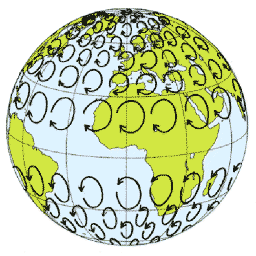
Explain the cause of the Coriolis force
Coriolis force is caused by rotation of the earth. Any object in motion relative to the rotating frame of reference will deflect to the left in the Southern hemisphere
Coriolis is not a real force – more an apparent force – known as the Coriolis Effect
Measurement of the standard surface wind
Standard surface wind as stated in aviation observations and forecasts, is measured at the top of a 10 metre mast and averaged out over a 10 minute period
State the direction in which the following two forces act:
a)  pressure gradient;
b)  Coriolis force.
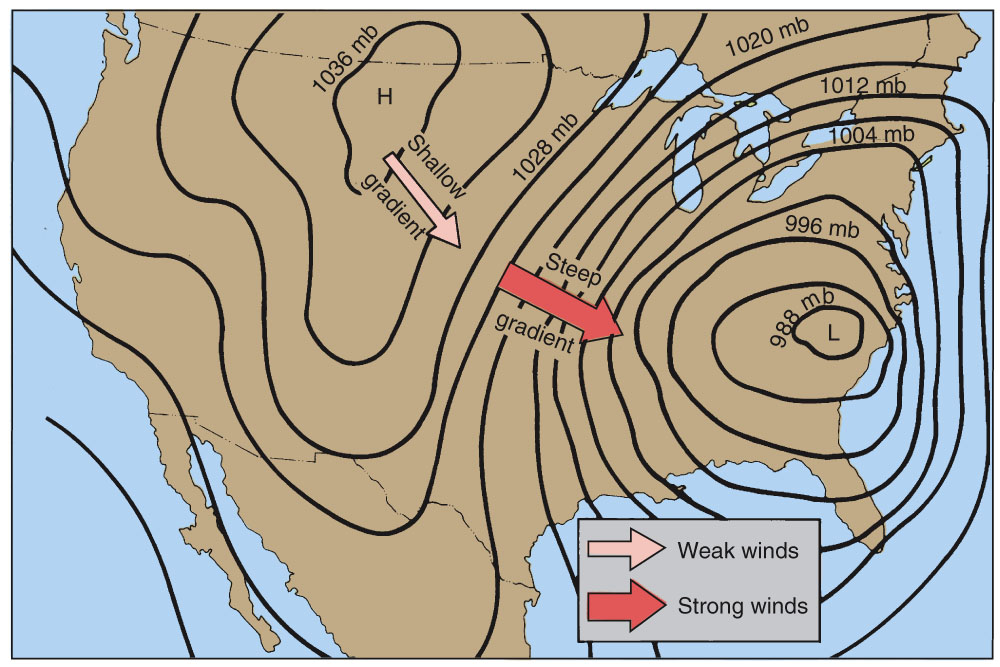
a) Pressure gradient is a force which always acts at right angles to the isobars and always from high to low
b) Under the influence of the Coriolis force the movement of air from high to low pressure is prevented from doing so and is deflected to the Left in the Southern hemisphere
Describe how stable and unstable air affect flying conditions.
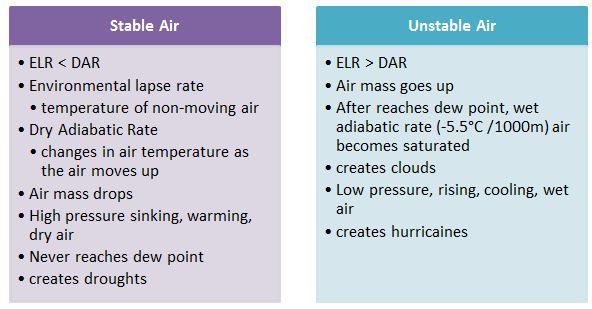
Stable air with high moisture
Produces stratiform cloud or fog; bad conditions for VFR flying
Less moisture content -> cloud bases are higher -> visibility may be unsafe if associated with rain or drizzle
Unstable air
Produces cumuliform cloud – if closely spaced and shower activity is present; unsuitable for VFR flight
When less moist, cloud bases will be higher, cumulus clouds wider apart visibility should be good, light turbulence possible but conditions generally good for VFR flight
Describe weather conditions and degrees of visibility in:
a)  stable air;
b)  unstable air.
a) Stable conditions associated with poor visibility due to fog and stratiform cloud
b) Unstable conditions are normally associated with cumulus cloud, which can reduce visibility
Describe the types of cloud that could be expected in:
a)  stable saturated air;
b)  unstable saturated air.
a) When air is stable and water content is high, when a rising mechanism is present low level Stratiform cloud or fog may form.
If stable air is less moist the cloud base will be higher
b) When air is unstable and moisture content is high, low level cumuliform cloud will form.
When air is less moist cloud bases will be higher and cumulus clouds are often wider apart
Explain the effect of increasing surface temperature on the base of convective cloud, given a constant moisture content.
________________________________________
Discussion
Explain how different Dew Point values determine the cloud base.
If the air has a very low Dew Point, ie it is very dry even though the rising parcels cool at the DALR of 3 degrees / 1000ft they will not cool to below the dew point and therefore condensation will not take place.
If the air’s Dew Point is higher ie air is moist the rising dry air will cool adiabatically to below Dew Point and condensation occurs. Cloud will form and since the air is unstable this will be cumuliform cloud.
Explain the factors involved in thermal rising of air.
Thermal rising takes place when the surface becomes hot and very dry air rises due to instability.
If the air is less dry, cumulus cloud will form at some height and this will be lower if the water content of the unstable air is greater.
The hotter the surface and the drier the air the higher the cumulus cloud base
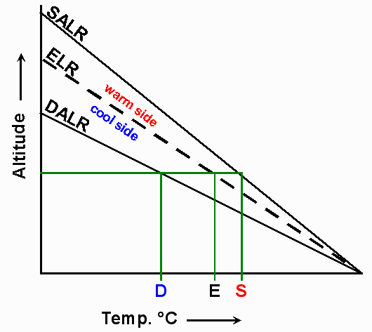
Explain how the relationship between the ELR and SALR can be used to determine the stability or instability of saturated air.
Stable saturated air – SALR lies below ELR
Unstable saturated air – SALR lies above ELR